Wetland Delineations in Florida
Southwest Florida Wetland Delineation Services
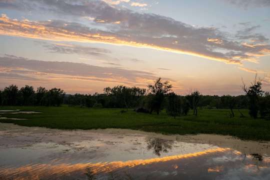
Understanding the wetlands on your property is a critical first step in any commercial development project. Wetland delineation determines the exact boundaries of regulated wetlands, to help make sure you comply with federal, state, and local environmental regulations. Failing to properly identify these areas can lead to costly fines, project delays, and unexpected permitting challenges.
Developing wetlands can be costly and permit acquisition is time-consuming, but it doesn’t have to be. Qualified wetland consultants provide the most cost-effective way forward.
At Creek Engineering, we provide accurate and efficient wetland evaluations for commercial developers, home builders, and land planners across Southwest Florida. Our experienced team works closely with regulatory agencies to ensure compliance while helping you maximize your developable land. Whether you’re in the early planning stages or need support with the permitting process, we’re here to keep your project goals moving forward.
Contact us today to get started!
Why Wetland Delineation is Essential for Developers
- Prevent costly project delays and fines.
- Ensure compliance with Florida DEP, USACE, and local regulations.
- Maximize developable land while protecting wetlands.
Creek Engineering provides specialized wetland determination and delineation surveys, the essential first step in due diligence for land purchase and development planning.
These surveys identify and define wetland boundaries, ensuring compliance with local government regulations, the Florida Department of Environmental Protection (FDEP), and Water Managemente Districts (WMD). By conducting a survey of wetland locations early in the due diligence process, we help clients navigate federal regulations, avoid regulatory violations and create effective mitigation strategies.
Our team serves Lakeland, Winter Haven, North Port, Sarasota, Tampa, Orlando, St. Cloud, and Wesley Chapel, providing essential information for landowners and developers to pursue sustainable, compliant site development and ensure project success.
Who We Serve in Southwest Florida
- Commercial Developers
- Home Builders
- Civil Engineers & Land Planners
- Municipalities & Government Agencies
Why Choose Creek Engineering for Wetland Delineations?
By now, you know that building and developing property in Southwest FL requires a specific set of skills and experience.
Our Port Charlotte engineering team has 30+ years of experience working with builders in Southwest Florida, and we’re not going anywhere soon. Our wetland services give you the details you need for accurate project planning, so you don’t get any unwelcome surprises on your federal permit applications.
- Experience in Southwest Florida’s unique wetland ecosystems.
- Fast, reliable assessments to keep your project on schedule.
- Strong relationships with local and state regulatory agencies.

Locations We Serve
We’re based in the city of Port Charlotte and we provide wetland consulting services to all of Southwest Florida, especially the following counties:
- Charlotte County – Port Charlotte, Punta Gorda, Deep Creek, Rotonda West, Cleveland, Burnt Store, Charlotte Harbor, etc.
- Collier County – Naples, Everglades City, Naples Manor, Goodland, etc.
- DeSoto County – Arcadia, Ft. Ogden, Nocatee, etc.
- Hendry County – LaBelle, Harlem, Clewiston, Montura, etc.
- Hillsborough County – Tampa, Ruskin, Plant City, etc.
- Lee County – Bonita Springs, Fort Myers, Cape Coral, Naples, Estero, etc.
- Manatee County – Bradenton, Lakewood Ranch, Bayshore Gardens, Palmetto, etc.
- Sarasota County – North Port, Venice, Sarasota, Arcadia, Englewood, Nokomis, etc.
Our Wetland Delineation Process
Our wetland consultants have been trained in both the Florida Unified Wetland Delineation Methodology (Chapter 62–340, F.A.C.) and the Army Corps of Engineers’ Wetland Delineation Manual (1987). Here’s a preview of the process we’ve created to help support commercial developers in our Southwest Florida area:
Site Assessment
Initial review of property and existing maps.
Field Investigation
Identifying presence of wetland boundaries based on soil, vegetation, and hydrology.
Regulatory Coordination
Working with agencies to confirm delineations.
Reporting & Permitting Support
Providing detailed reports to support permits and approvals.
Our Partners & Network
Contact Us
Need Wetland Consulting services for your upcoming development project? Contact our team today:
Gopher Tortoise Relocation
Frequently Asked Questions
A wetland assessment helps property owners and developers identify and map the boundaries of wetlands through flagging techniques.
The final decisions of wetland boundaries and wetland mapping are governed by the Florida Dept. of Environmental Protection and U.S. Army Corps of Engineers
The simple truth is that upland areas of Florida are generally easier to develop, but not always as valuable as our coastal region. Thankfully, knowing the extent of wetland boundaries can help you decide where (and if) to build or buy.
The cost of a wetland delineation report can vary significantly depending on several factors, including the project area size, the complexity of the site, and the specific requirements of the project. Generally, smaller plots may start around $1,500 to $3,000 for a basic assessment, while larger or more complicated properties can range from $3,000 to $10,000 or more.
To get an accurate estimate, contact us to request a consultation. Our team can evaluate your specific situation and provide a tailored quote that reflects the necessary scope of work.
The timeline for completing a wetland delineation report can vary based on the size and complexity of the site, as well as seasonal factors that may impact site access and vegetation visibility. Typically, the field investigation can take anywhere from one to several days, depending on the size of the property.